What are GPS Sensors Used for, Especially in Drones?

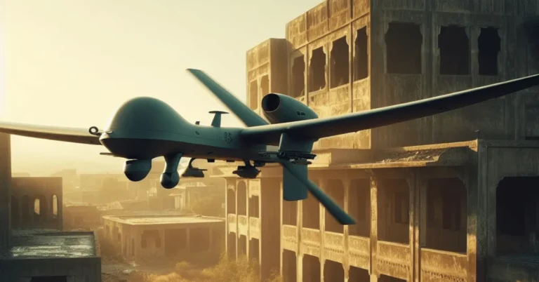
Global Positioning System (GPS) sensors are pivotal in modern drone technology, serving as the backbone for navigation, positioning, and real-time data collection.
These sensors are integral components that enable drones to determine their precise location by triangulating signals from satellites orbiting the Earth. Understanding what GPS sensors are used for in drones is crucial to appreciating their myriad applications.
GPS sensors facilitate accurate navigation, allowing drones to follow predetermined flight paths with a high degree of precision.
This is particularly important in industries where exact positioning is critical, such as agriculture, where drones are used to monitor crop health, or in logistics, where they assist in efficient package delivery.
Furthermore, GPS sensors enable drones to hover steadily and return to a set home point, enhancing safety and reliability during operations.
Real-time data collection is another significant advantage provided by GPS technology in drones. Equipped with these sensors, drones can collect geospatial data, which is vital for mapping and surveying tasks.
This capability has revolutionized fields such as environmental monitoring, disaster management, and construction, where up-to-date information is essential for decision-making and strategic planning.
The impact of GPS technology on the drone industry is profound. For commercial applications, GPS-enabled drones have streamlined operations, reduced costs, and opened new avenues for innovation.
For instance, in the realm of aerial photography and videography, GPS sensors allow for precise, repeatable flight paths, enabling high-quality, consistent footage. Recreational users also benefit from enhanced ease of use and improved safety features provided by GPS capabilities.
Unsure about Drone Laws in New Jersey: Do I Need a Permit to Fly My Drone? Check out our guide for a quick rundown!
Applications of GPS Sensors in Drones
GPS sensors have revolutionized the functionality of drones, playing a pivotal role in various applications that span multiple industries. One of the primary uses of GPS sensors in drones is in aerial photography.
By providing precise location tracking, these sensors enable photographers to capture high-quality, stable images and videos from specific coordinates, ensuring accuracy and consistency.
This capability is particularly beneficial for capturing panoramic landscapes, real estate properties, and events.
In the realm of surveying and mapping, GPS sensors are indispensable. They facilitate the creation of detailed and accurate maps by allowing drones to follow pre-programmed routes with pinpoint accuracy.
This is particularly useful for civil engineering projects, environmental monitoring, and urban planning. With the help of GPS sensors, drones can cover large areas efficiently, reducing the time and cost associated with traditional surveying methods.
Agriculture has also significantly benefited from the integration of GPS sensors in drones. Farmers use drones equipped with these sensors for precision agriculture, which includes monitoring crop health, assessing field conditions, and optimizing irrigation systems.
GPS-enabled drones can autonomously fly over fields, collecting data that helps in making informed decisions, thereby enhancing crop yields and reducing resource wastage.
In search and rescue operations, the importance of GPS sensors cannot be overstated. Drones equipped with these sensors can quickly locate individuals in distress, especially in challenging terrains or disaster-stricken areas.
The precise location tracking capabilities of GPS sensors enable rescue teams to deploy drones to specific coordinates, significantly increasing the chances of finding and rescuing missing persons promptly.
Delivery services are another area where GPS sensors in drones are making a substantial impact. Companies are leveraging drones for last-mile delivery, ensuring that packages reach their destinations efficiently and safely.
GPS sensors facilitate efficient route planning and autonomous flying capabilities, allowing drones to navigate complex urban environments and deliver goods to precise locations without human intervention.
Overall, the integration of GPS sensors in drones has significantly enhanced their functionality, making them invaluable tools across various sectors.
From aerial photography and surveying to agriculture, search and rescue, and delivery services, the precise location tracking, efficient route planning, and autonomous capabilities enabled by GPS sensors have expanded the possibilities of what drones can achieve.
Thinking of silent flight? We explore drones with minimal noise in our informative article.
Types of GPS Sensors Used in Drones
GPS sensors play a pivotal role in the functionality and precision of drones, offering diverse applications and levels of accuracy. Understanding the types of GPS sensors utilized gives insight into their varied use-cases and technological intricacies.
Basic GPS: The most common type, basic GPS, provides standard positioning information by receiving signals from multiple satellites.
It is widely used in consumer drones for basic navigation and location tracking. While not the most accurate, it is sufficient for general use, such as recreational flying, simple mapping tasks, and basic photography.
Differential GPS (DGPS): DGPS enhances the accuracy of basic GPS by correcting signal errors using a network of fixed ground-based reference stations.
This type of GPS sensor is particularly useful for applications requiring higher precision, such as agricultural drones for crop monitoring, and surveying drones for creating detailed maps and models. DGPS can reduce positional errors to within a few centimeters.
Real-Time Kinematic (RTK) GPS: RTK GPS offers the highest level of accuracy by utilizing phase measurements of the satellite signals and a base station to provide real-time corrections.
This results in centimeter-level precision, making RTK GPS ideal for industries that demand extreme accuracy.
Examples include precision agriculture, infrastructure inspection, and professional cinematography, where precise positioning of the drone is crucial for data collection and operational efficiency.
Assisted GPS (A-GPS): A-GPS improves the performance of GPS by using additional data from network resources, such as cell towers, to speed up the time to first fix (TTFF) and improve accuracy in challenging environments.
Drones equipped with A-GPS are highly effective in urban settings or areas with poor satellite visibility. This technology ensures reliable positioning for tasks such as urban planning, emergency response, and delivery services in congested cities.
Each type of GPS sensor has its unique advantages and is tailored to specific drone applications. By selecting the appropriate GPS sensor, drone operators can optimize performance, accuracy, and reliability for their particular use-case.
Curious about whether a landing pad helps a drone land? Learn more about the benefits of landing pads in our guide on [landing pads].
Accuracy of Various GPS Sensors for Drones
In the realm of drone technology, the accuracy of GPS sensors plays a critical role in ensuring precise navigation and operation.
Different types of GPS sensors offer varying degrees of accuracy, influenced by factors such as signal quality, atmospheric conditions, and satellite geometry. Understanding these factors is essential for selecting the appropriate GPS sensor for specific drone applications.
Basic GPS, commonly used in consumer-grade drones, provides an accuracy range of approximately 2 to 10 meters.
While sufficient for general navigation, this level of accuracy may not meet the demands of applications requiring high precision, such as aerial surveying or precision agriculture.
These basic GPS sensors are often susceptible to signal degradation caused by atmospheric conditions like ionospheric and tropospheric delays, as well as multipath effects where signals bounce off structures or terrain before reaching the receiver.
For applications demanding higher accuracy, Differential GPS (DGPS) and Real-Time Kinematic (RTK) GPS are preferred. DGPS enhances accuracy by using a network of fixed ground-based reference stations to correct satellite signals, achieving accuracy levels within 1 to 3 meters.
This method significantly reduces errors caused by atmospheric conditions and satellite geometry. DGPS is often employed in maritime navigation and construction surveying, where enhanced precision is crucial.
RTK GPS takes accuracy a step further by providing real-time corrections to the GPS signals, achieving centimeter-level precision.
This high accuracy is achieved through a base station transmitting correction data to the drone’s GPS receiver, thus mitigating errors from atmospheric conditions and satellite geometry.
RTK GPS is indispensable in applications like geospatial mapping, where exact positioning is paramount. The importance of such high accuracy cannot be overstated, as it directly impacts the quality and reliability of data collected during drone operations.
Overall, the choice of GPS sensor in drones hinges on the specific requirements of the application. While basic GPS suffices for general navigation, advanced options like DGPS and RTK GPS are essential for tasks demanding high precision.
Understanding what GPS sensors are used for, especially in drones, allows for informed decisions that enhance operational efficiency and data accuracy.
Drones vs. Defenses: Can Air Defense Missiles Effectively Target and Destroy Drones? We’ll explore this topic next.
Limitations of Using GPS Sensors in Drones
While GPS sensors have revolutionized the capabilities of drones, there are several limitations and challenges that can affect their performance and reliability. One of the primary issues is signal interference.
GPS signals, which are crucial for accurate positioning, can be disrupted by various factors such as atmospheric conditions, solar flares, and even electronic devices.
This interference can lead to inaccuracies in location data, ultimately impacting the drone’s navigation and operational efficiency.
Another significant challenge is multipath errors. These occur when GPS signals reflect off surfaces such as buildings, water, or the ground before reaching the drone’s receiver.
These reflected signals can confuse the receiver and lead to errors in calculating the drone’s exact position. This is particularly problematic in urban environments where buildings and other structures are prevalent, making it difficult for drones to maintain precise location data.
Dependency on satellite availability is another critical limitation. GPS sensors rely on signals from multiple satellites to triangulate a precise position.
In areas with limited satellite visibility, such as densely forested regions or indoor environments, the accuracy of GPS sensors can be significantly compromised. This dependency can result in unreliable positioning information, which is detrimental to the performance and safety of drones.
In urban or densely forested areas, GPS signal degradation is a common issue. Tall buildings, mountains, and thick canopies can obstruct signals, leading to poor reception and increased chances of signal loss.
This can cause drones to lose their way, potentially leading to crashes or unplanned landings. Additionally, the reliance on GPS sensors in such challenging environments may necessitate the integration of supplementary navigation systems, increasing the complexity and cost of drone operations.
These limitations underscore the need for continuous advancements in GPS technology and the development of complementary systems to enhance the reliability and performance of drones.
Understanding what GPS sensors are used for and their limitations is crucial for optimizing their application in various environments, ensuring safer and more efficient drone operations.
Wondering which DJI drones can handle a splash? Check out our guide to see if your model is up for the challenge!
Enhancing Drone Functionality with Combined Sensor Data
Integrating GPS data with other sensor technologies significantly enhances the functionality of drones, transforming them into highly efficient and versatile tools.
GPS sensors, fundamental to drone navigation, provide crucial location data, but their effectiveness is exponentially increased when combined with additional sensor data streams.
The integration of Inertial Measurement Units (IMUs), cameras, LiDAR, and other sensors results in a comprehensive sensor fusion that improves navigation, stability, and obstacle avoidance.
IMUs, which consist of accelerometers and gyroscopes, work in conjunction with GPS sensors to deliver precise positioning and orientation information.
By merging GPS data with IMU readings, drones can maintain accurate flight paths and stable hovering, even in environments where GPS signals might be weak or unreliable.
This synergy ensures that the drone can correct its position and orientation in real-time, enhancing flight stability and control.
Additionally, cameras play a pivotal role in augmenting GPS data for improved functionality. Visual data from cameras can be processed to create detailed maps and models of the environment, aiding in navigation and obstacle avoidance.
For instance, drones employed in agriculture can use GPS combined with high-resolution cameras to monitor crop health and identify areas needing attention. The fusion of visual and GPS data allows for precise targeting and efficient resource allocation.
LiDAR sensors further elevate the capabilities of drones by providing high-resolution, three-dimensional mapping of the surroundings. When integrated with GPS data, LiDAR enhances the drone’s ability to detect and navigate around obstacles with remarkable accuracy.
This is particularly beneficial in complex environments such as urban areas or dense forests, where visual data alone might be insufficient. LiDAR’s ability to penetrate through foliage and other obstructions ensures that drones can operate safely and effectively.
Examples of sensor fusion leading to robust drone operations are abundant. In search and rescue missions, drones equipped with GPS, IMUs, cameras, and LiDAR can swiftly locate and reach individuals in distress, even in challenging terrains.
In industrial inspections, such as monitoring pipelines or power lines, these combined sensors enable drones to perform detailed inspections while maintaining precise positioning, thus enhancing both safety and efficiency.
Overall, the integration of GPS sensors with other advanced sensors like IMUs, cameras, and LiDAR significantly elevates the functionality of drones. This combination not only improves navigation and stability but also ensures reliable and safe operations across diverse applications.
For a smooth flight, propeller choice is key! Learn How Many Blades Should a Drone Have in our handy guide.
Case Studies: GPS Sensors in Real-World Drone Applications
GPS sensors have revolutionized the functionality and efficiency of drones across various industries, providing precise location tracking and navigation capabilities. In agriculture, for instance, drones equipped with GPS sensors are used for precision farming.
Farmers utilize these drones to monitor crop health, soil conditions, and overall farm management. One notable case is that of a large-scale farm in Iowa, where GPS-enabled drones helped reduce fertilizer usage by 20% and increased crop yield by 15%.
The ability to map and analyze vast agricultural fields in real time has enabled more informed decision-making and resource optimization.
In the construction industry, GPS sensors in drones have proven invaluable for site surveying and project management. A prominent example is the use of drones in the construction of the Crossrail project in London.
Drones provided highly accurate topographic maps and 3D models of the construction site, significantly reducing the time and cost of traditional surveying methods.
The integration of GPS technology allowed for precise tracking of equipment and materials, ensuring that the project stayed on schedule and within budget.
Environmental monitoring is another area where GPS sensors in drones have made a significant impact. For example, in the Amazon rainforest, drones equipped with GPS sensors are used to monitor deforestation and wildlife habitats.
These drones gather geospatial data that helps researchers track changes in the environment and implement conservation strategies more effectively. The ability to collect data from remote and inaccessible areas has been a game-changer for environmental scientists.
In emergency response situations, the use of GPS sensors in drones has proven to be life-saving. During the 2017 wildfires in California, drones equipped with GPS technology were deployed to assess fire spread and aid in evacuation planning.
These drones provided real-time data to first responders, allowing them to quickly identify hotspots and allocate resources more efficiently.
The integration of GPS sensors enabled precise mapping of the affected areas, which was crucial for coordinating rescue operations and ensuring public safety.
These case studies highlight the diverse applications and benefits of GPS sensors in drones. From agriculture to construction, environmental monitoring to emergency response, the integration of GPS technology has proven to be a powerful tool for enhancing operational efficiency and achieving better outcomes across various sectors.
Future Advancements in GPS Technology for Drones
The future of GPS technology in drones promises a landscape of remarkable advancements poised to redefine the boundaries of what these aerial devices can achieve. As the demand for precision and reliability in drone navigation continues to rise, several key trends and innovations are expected to emerge.
Firstly, we can anticipate improved accuracy in GPS sensors, a crucial factor for applications requiring meticulous location tracking. Emerging technologies, such as Real-Time Kinematic (RTK) GPS and Precise Point Positioning (PPP), are set to deliver centimeter-level accuracy.
This heightened precision will be invaluable for sectors like agriculture, where drones are used for crop monitoring and precision farming, as well as in surveying and mapping, where exact measurements are paramount.
Another significant advancement is faster signal acquisition. Next-generation GPS sensors are expected to drastically reduce the time it takes for drones to lock onto satellite signals.
This improvement will enhance the efficiency of drone operations, particularly in environments where rapid deployment is necessary, such as search and rescue missions or disaster response scenarios.
Integration with 5G networks represents another transformative leap. The high-speed, low-latency connectivity provided by 5G will enable real-time data transmission and processing.
This synergy between GPS sensors and 5G technology will facilitate more sophisticated applications, such as real-time traffic monitoring, dynamic route adjustments, and even autonomous drone swarms that can communicate and coordinate with unprecedented efficiency.
Advancements in satellite technology are also on the horizon. With the deployment of next-generation satellite constellations, including those from private companies, we can expect enhanced global coverage and signal reliability.
These improvements will be particularly beneficial for drones operating in remote or challenging environments, ensuring consistent performance and expanding the geographical range of their operations.
Collectively, these innovations in GPS technology will significantly enhance the capabilities of drones, unlocking new possibilities for their use.
From precision agriculture and infrastructure inspection to environmental monitoring and emergency response, the future of drones equipped with advanced GPS sensors is set to be both exciting and transformative.