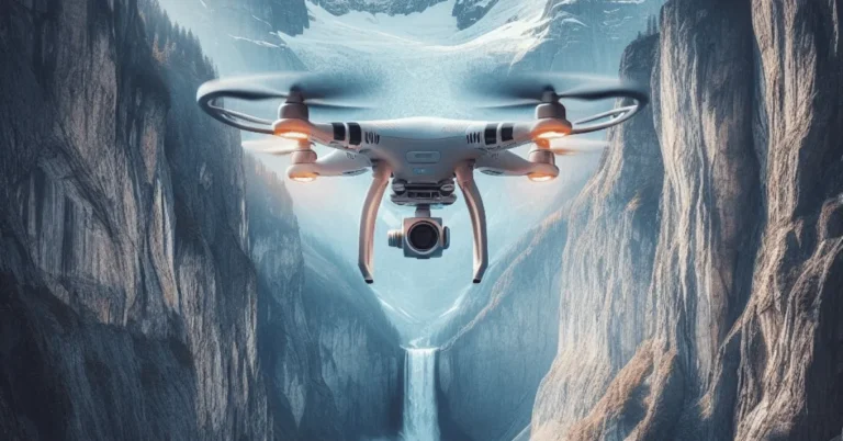
Benefits of Drone Mapping (2023)
Drone mapping, also known as aerial surveying or photogrammetry, has emerged as a transformative technology in various industries.
By utilizing drones equipped with advanced cameras and sensors, businesses and professionals can create highly accurate and detailed maps of large areas cost-effectively and efficiently.
In this article, we will explore the top benefits of drone mapping, how drones are utilized in this process, any potential disadvantages, and the promising future of drones in the field of mapping.
Whether it’s for land surveying, construction, agriculture, or environmental monitoring, drone mapping offers unparalleled advantages, revolutionizing the way we gather and analyze geographic data.
Key Takeaways
- Drone mapping revolutionizes traditional surveying methods in various industries.
- Increased efficiency and time savings with autonomous drone missions.
- Enhanced data accuracy leads to informed decision-making.
- Improved safety as drones access hard-to-reach or hazardous areas remotely.
- Diverse applications in agriculture, construction, and more.
- Cost-effectiveness and favorable ROI make drone mapping economical.
- Access to sophisticated mapping software streamlines workflows.
- Future trends promise more significant developments in drone mapping.
- Some disadvantages include limited payload capacity and flight time constraints.
- Compliance with regulations is necessary for legal and safe drone mapping.
What are the top benefits of drone mapping?
Drone mapping has emerged as a game-changer in various industries, revolutionizing traditional mapping and surveying methods.
By leveraging the capabilities of unmanned aerial vehicles (UAVs), businesses and professionals can gain access to a plethora of advantages, ranging from enhanced efficiency to superior data accuracy.
Increased Efficiency and Time Savings:
One of the most significant advantages of drone mapping is its ability to expedite surveying and mapping processes.
Autonomous drone missions can cover vast areas in a fraction of the time it would take traditional methods.
This boost in efficiency translates to significant time savings, allowing businesses to complete projects faster and allocate resources more effectively.

Enhanced Data Accuracy:
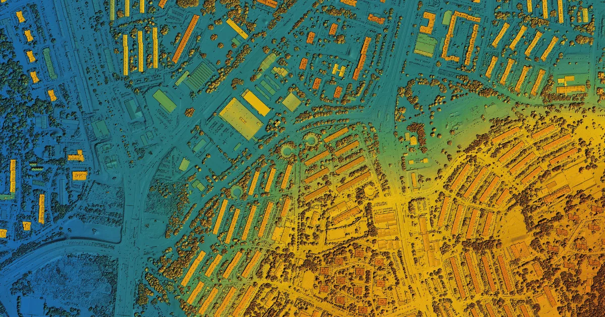
Drone mapping delivers unparalleled data accuracy and precision. By capturing high-quality aerial images and leveraging advanced sensors, drones produce detailed and up-to-date maps and 3D models.
These accurate representations enable businesses to make informed decisions, identify trends, and plan future strategies with confidence.
Improved Safety Measures:
Drone mapping eliminates the need for manual on-site data collection, reducing the risks associated with traditional surveying.
Human operators can now access hard-to-reach or hazardous areas remotely, enhancing safety for workers and mitigating potential accidents or injuries.
Diverse Applications across Industries:
The versatility of drone mapping extends to various sectors.
Industries such as agriculture, construction, real estate, environmental monitoring, and wildlife protection benefit immensely from the data-driven insights and efficient surveying capabilities provided by drones.
Each industry can tailor drone mapping to suit its specific needs and objectives.
Cost-Effectiveness and ROI:
Investing in drone mapping technology offers a favorable return on investment (ROI) due to its cost-effectiveness.
Reduced manpower and time requirements translate to lower operational costs, making drone mapping an economical choice for businesses seeking accurate and comprehensive mapping solutions.
Advanced Mapping Software Options:
Drone mapping is supported by a wide array of sophisticated software tools.
From acquisition to data processing, the availability of cutting-edge mapping software streamlines the entire workflow, enhancing the overall mapping experience and data analysis.

Future Trends and Developments:
As drone technology continues to advance, we can expect even more significant developments in drone mapping.
From improved camera resolutions to more efficient surveying algorithms, the future promises continued enhancements that will further solidify drone mapping’s role in transforming industries.
How drones are used in drone mapping?
Drones play a pivotal role in drone mapping, offering advanced capabilities that revolutionize traditional surveying and mapping methods.
Utilizing these unmanned aerial vehicles (UAVs), professionals can achieve highly accurate and detailed maps of large areas cost-effectively and efficiently. Here’s how drones are used in drone mapping:
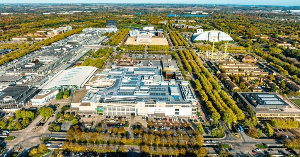
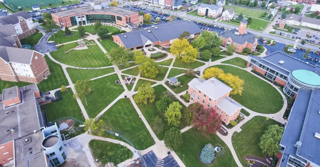
Aerial Data Collection: Drones are equipped with high-resolution cameras and advanced sensors that capture aerial images and data from different angles and altitudes. These images serve as the foundation for creating maps and 3D models.
Autonomous Flight: Drones are programmed to follow pre-defined flight paths autonomously. This feature allows for systematic coverage of the area, ensuring comprehensive data collection with minimal human intervention.
Read More: What is Auto Orientation on a Drone? (How to Use it?)
Photogrammetry: The images captured by the drone are processed using photogrammetry software. This technique involves stitching multiple images together and triangulating points to generate accurate geospatial data.
Real-Time Monitoring: Some advanced drone mapping systems offer real-time monitoring capabilities. This means operators can view live feeds from the drone’s camera during the flight, enabling immediate data analysis and adjustments to the surveying process.

Terrain Analysis: Drones can fly at varying altitudes and angles, enabling them to capture data from challenging terrains, such as mountains, forests, and cliffs. This data is vital for comprehensive terrain analysis and mapping.
3D Modeling: By combining aerial images with data from laser scanners or LiDAR (Light Detection and Ranging) sensors, drones can create highly accurate 3D models of the surveyed area, providing an in-depth understanding of the landscape.
Multispectral Imaging: Drones can also be equipped with multispectral cameras that capture data beyond visible light, such as infrared and thermal data. This capability is particularly valuable for agriculture, environmental monitoring, and vegetation analysis.
Data Processing: Once the data is collected, specialized software processes the images and geospatial data to create precise ortho mosaics, elevation maps, point clouds, and other mapping outputs.
Geographic Information System (GIS) Integration: Drone mapping data can be seamlessly integrated into GIS software, allowing businesses and professionals to overlay drone data with existing geospatial data for more comprehensive analysis.
Data Analysis and Decision-Making: The accurate and up-to-date mapping data generated by drones facilitate data-driven decision-making. Businesses and organizations can use this data to plan projects, assess environmental changes, monitor construction progress, and more.
Overall, drones have revolutionized the mapping and surveying industries by providing efficient, safe, and highly accurate data collection capabilities.

As drone technology continues to advance, we can expect even more innovative applications and enhancements in drone mapping, further benefiting various industries and transforming the way geographic data is gathered and analyzed.
Big Tip For You
In 2023 and beyond, drone mapping offers unprecedented advantages, from increased efficiency and data accuracy to enhanced safety measures.
Whether you’re in construction, agriculture, real estate, or any other industry, leveraging drone mapping technology can transform your operations, boost decision-making, and unlock new growth opportunities.
Stay ahead of the curve and harness the potential of drones to revolutionize the way you gather and analyze geographic data.
Are there any disadvantages of drones in drone mapping?
Yes, there are some disadvantages to using drones in drone mapping:
Limited Payload Capacity: Drones have weight restrictions, limiting the size and weight of the sensors they can carry. This can impact the types of sensors and equipment that can be used for data collection, potentially affecting the quality and scope of the mapping data.
Flight Time and Range: Most drones have limited flight times due to battery constraints. This can result in shorter mapping missions, requiring multiple flights to cover large areas. Additionally, the range of drones is limited, which may be a challenge when mapping expansive regions.
Weather Dependency: Drone mapping is heavily reliant on favorable weather conditions. High winds, rain, or extreme temperatures can disrupt or even prevent drone flights, affecting data collection schedules and project timelines.
Data Processing Challenges: Drone mapping generates large amounts of data that require sophisticated processing software and hardware. The processing time can be lengthy, especially for high-resolution data, which may slow down the overall mapping workflow.
Regulatory Restrictions: Operating drones for mapping purposes requires adherence to aviation regulations and airspace restrictions. Compliance with these regulations can be complex and time-consuming, adding to the operational challenges of drone mapping.
Risk of Technical Failures: Like any technology, drones can experience technical malfunctions or failures during flights. These issues may lead to data loss or incomplete mapping missions, requiring redundant data collection efforts.
Privacy and Security Concerns: Drones capturing aerial imagery raise privacy concerns, especially in urban or populated areas. The use of drones for mapping should be conducted with consideration for privacy laws and ethical practices.
Lack of Human Contextual Understanding: While drones provide accurate and detailed geographic data, they lack human contextual understanding. Human surveyors can interpret and assess specific conditions or anomalies that drones may not detect or understand.
What is the future of drones in drone mapping?
As drone technology continues to improve, we can expect to see even more innovative applications and enhancements in drone mapping.
Here are some of the trends that are shaping the future of drone mapping:
- Improved camera resolutions: As camera resolutions continue to improve, drones will be able to capture even more detailed and accurate images, which will lead to even better maps and 3D models.
- More efficient surveying algorithms: Drone mapping software is constantly being updated with new and more efficient surveying algorithms. This will help to reduce the time and cost of drone mapping projects.
- Increased payload capacity: As drone technology advances, drones will be able to carry larger and heavier sensors, which will allow for more comprehensive data collection.
- Extended flight times and range: As battery technology improves, drones will be able to fly for longer periods and cover larger areas. This will make it possible to map more extensive regions in a single flight.
- Reduced weather dependency: Drones are still affected by weather conditions, but as drone technology advances, drones will become more resistant to wind, rain, and extreme temperatures. This will make it possible to map in more challenging environments.
In addition to these technical advancements, we are also seeing a growing number of industries adopting drone mapping technology. Drone mapping is already being used in a wide range of applications, including:
- Construction: Drones can be used to survey construction sites, track progress, and identify potential problems.
- Agriculture: Drones can be used to survey crops, monitor soil conditions, and assess damage from pests or diseases.
- Real estate: Drones can be used to create 3D models of properties, which can be used to help buyers visualize the space.
- Environmental monitoring: Drones can be used to survey forests, track wildlife, and monitor pollution levels.
As drone technology continues to evolve, we can expect to see even more innovative applications for drone mapping. The future of drone mapping is very bright, and the possibilities are endless.
Important FAQs
Can drones be used for mapping large agricultural fields?
How accurate are the maps and 3D models generated by drone mapping?
Are there any legal restrictions or permits required for conducting drone mapping projects?
Depending on the country and location, specific permits and licenses may be necessary to conduct drone mapping projects legally and safely.
Can drones be used for mapping in challenging terrains, such as dense forests or mountainous regions?
How do drones contribute to environmental monitoring and wildlife protection?
They can track changes in ecosystems, monitor wildlife populations, and assess environmental impacts, aiding in conservation efforts and research.
Are there any privacy concerns related to drone mapping in urban areas?
What are some cost-effective applications of drone mapping for small businesses?
How does real-time monitoring during drone flights enhance the mapping process?
This capability enables immediate data analysis, ensuring that the desired data is collected, and adjustments can be made to the surveying process in real time for better results.
Final Thoughts
Drone mapping has emerged as a transformative technology, revolutionizing traditional mapping and surveying methods across various industries.
The use of unmanned aerial vehicles (UAVs) equipped with advanced cameras and sensors enables businesses and professionals to achieve highly accurate and detailed maps of large areas cost-effectively and efficiently.
The top benefits of drone mapping include increased efficiency and time savings, enhanced data accuracy, improved safety measures, diverse applications across industries, cost-effectiveness, and access to advanced mapping software options.
Despite these advantages, drone mapping also comes with some challenges, such as limited payload capacity, flight time constraints, weather dependency, and data processing complexities.
Looking forward, the future of drone mapping is promising, with ongoing advancements in camera resolutions, surveying algorithms, payload capacity, and flight times.
As drone technology continues to evolve, we can expect to see even more innovative applications and benefits in the field of mapping, benefiting industries ranging from construction and agriculture to environmental monitoring and real estate.
Images by Canva.com
Best Reading Light To Not Disturb Partner (2023)
“Sharing a bed but want to keep reading? 📖 Check out our 2023 guide on the best reading lights that won’t disturb your partner. Brighten your reading without the bother – read now!”